Kariz Underground City on Kish Island
Qanat channels, wells and the island’s marine rock

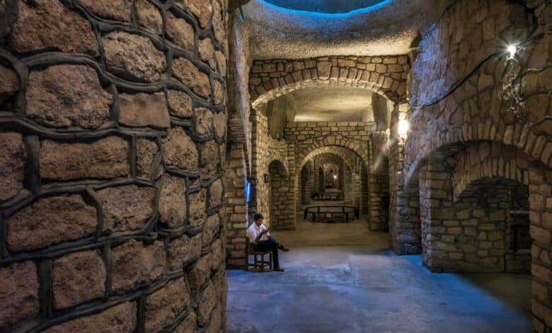
Kariz on Kish Island is a former water-supply system adapted as an underground visitor complex. Its channels, wells and shell-bearing rock bring together the island’s water history and marine geology. The modern attraction occupies an older qanat; it was not originally an inhabited underground city.
Contents
The Historical Depths of Kariz Kish
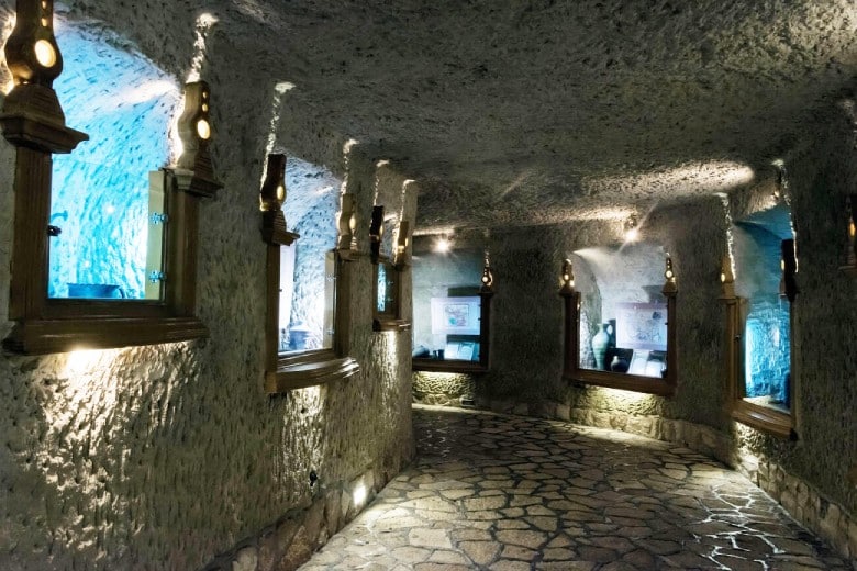
Iran’s official tourism portal describes the qanat as more than 2,500 years old. That is the reported age of the waterworks, rather than the age of every passage, support or visitor facility now seen underground.
The route passes beneath a roof containing shells and fossil material. Look at the rock around the passages as well as the built arches and supports: the natural formation and the later adaptation are different parts of the visit.
What Will You Discover in Kariz Kish?
- Shells and fossil material exposed in the rock
- A ceiling adorned with sea shells and corals
- Marine rock exposed around the passages. Researchers have dated coral from Kish’s raised reef terraces to more than one Late Pleistocene interval. Those samples came from terraces elsewhere on the island and do not date the ceiling above the visitor route.
Highlights of Kariz Kish
- Fossil displays, where specimen labels should distinguish an object’s identity from its geological age
- The Persian Gulf Museum
- The ancient Kariz aqueduct
- Various geological layers
- Kariz wells
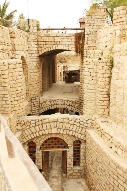
Visit Iran describes a network of three qanats and 274 wells. Some shafts remain intact, while others have been adapted to bring light and air into the visitor spaces. The wells belong to the water system; the modern complex makes parts of that infrastructure accessible for a closer look.
IRAN GROUP TOURS
Explore sample small-group routes. Departure dates, availability and final prices are confirmed case by case before booking.
Iran 7-Day Tour
Final price and availability on request
Iran 9-Day Tour
Final price and availability on request

Iran 15-Day Tour
Final price and availability on request
Groundwater and Qanat Channels
Seasonal rain replenished the island’s groundwater. The underground channels carried it by gravity toward lower ground. Iran Press traces the channels from Safin and Baghu toward Harireh. The vertical shafts you see along the route and the tunnels below them served different purposes in the water system.
Conditions Below Ground
The below-ground passages offer shade from direct sun. Their cooler setting is a feature of the visit, but temperature alone does not establish the drinking quality of water.
Visiting the Underground City of Kariz in Kish
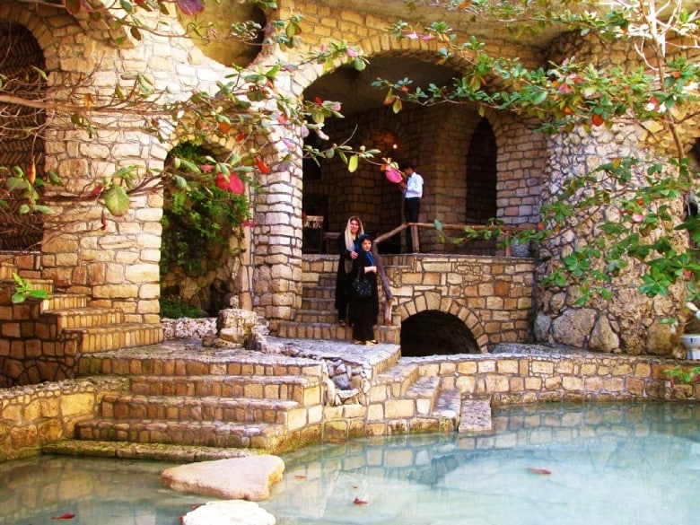
The Cultural Institute of Iran dates the rediscovery of the neglected waterworks to 1999. Its later adaptation created a visitor attraction around the older qanat. The ancient water system and the modern commercial spaces should be read as different phases.
Book Ferry Ticket
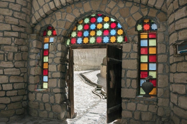
Visit Iran describes craft stalls, restaurants and cultural spaces within the adapted complex. These are later uses of the underground setting. The support structures and fitted-out passages belong to the conversion and maintenance of a visitor site, rather than proving that the original qanat was built as a city.
Planning your visit: Pair Kariz with Harireh to see the water system and the settlement it supplied. At Kariz, compare the exposed shell-bearing rock with the fitted arches. Look up at the shafts where they open above the modern visitor route.
Address: Kish Island, Mirmohana Boulevard, between Olympic and Farvar Squares, Kariz Kish City
Sources: Visit Iran. (n.d.). Kariz Underground City. Iran Press. (2022, May 24). Kariz underground city. Cultural Institute of Iran. (n.d.). Underground city of Kariz.
Mossadegh, Z., Parker, J., Gischler, E., Oschmann, W., Blakeway, D., & Eisenhauer, A. (2013). Palaeoecology of well-preserved coral communities in a siliciclastic environment from the Late Pleistocene (MIS 7), Kish Island. International Journal of Earth Sciences, 102, 545–570. The study concerns Kish outcrops; no specimen-specific radiometric date for the Kariz ceiling is asserted here.
Read More